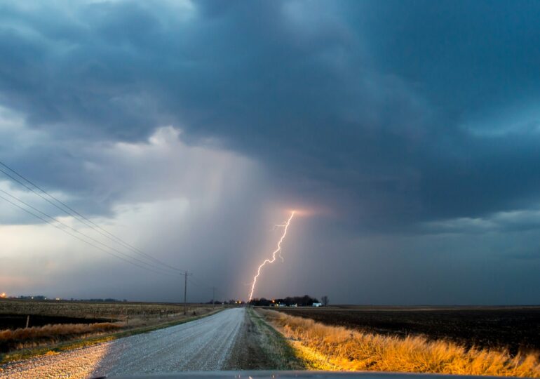
The National Meteorological Administration (ANM) issued several severe weather warnings on Thursday morning, valid until Friday evening, covering most of the country. Meteorologists are forecasting torrential rains, strong winds, thunderstorms, and hail, with some areas expecting over 70 liters of water per square meter.
Additionally, a special forecast was issued for Bucharest, with the capital under a yellow code for atmospheric instability and significant rainfall.
The storms will be followed by a sharp cooling as a polar air mass enters the country, lowering temperatures by around 10 degrees in just a few hours.
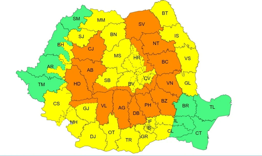
Yellow code in most of the country
The first warning is a yellow code valid from Thursday at 10:00 a.m. until Friday at 10:00 a.m.
Transylvania, Moldova, Oltenia, southern Banat, most of Muntenia and Maramureș, as well as mountainous areas are targeted.
ANM warns of periods of atmospheric instability characterized by torrential showers, thunderstorms, wind intensifications, and gusts of 50-70 km/h, as well as small hail.
In short intervals or through accumulation, water quantities will reach 20-30 l/sqm, with isolated areas exceeding 40-50 l/sqm.
Orange code for strong storms and heavy rainfall
Starting from Thursday at 12:00 p.m. until Friday at 10:00 a.m., there is an orange warning for accentuated atmospheric instability.
The counties of Cluj, Alba, Hunedoara, Vâlcea, Argeș, Dâmbovița, Prahova, Buzău, Vrancea, Bacău, Neamț, and Suceava, as well as mountainous areas in Harghita, Covasna, Brașov, Sibiu, and Gorj are affected.
In these regions, there will be significant torrential showers, intensified winds and gusts of 70-90 km/h, with isolated medium-sized hail.
Water quantities will range from 40-60 l/sqm and may exceed 70 l/sqm in some areas.
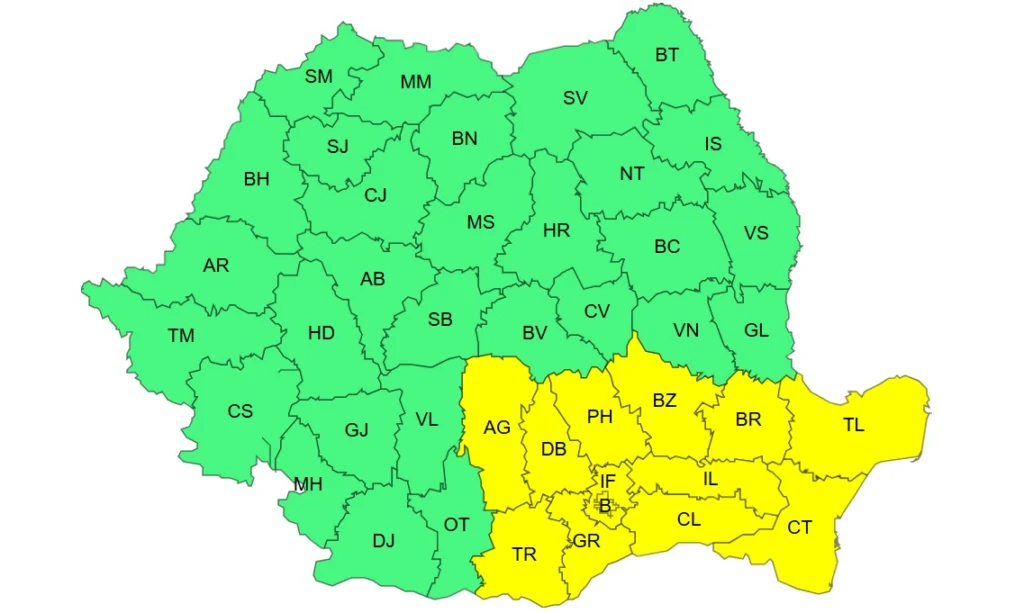
Friday, the warning moves towards southeast
After the expiration of the initial warnings, ANM issued a new yellow code valid for Friday between 10:00 a.m. and 9:00 p.m.
This covers Muntenia and Dobrogea, where significant rainfall is forecasted, accompanied by thunderstorms, lightning, and other manifestations of atmospheric instability.
Meteorologists estimate water quantities of 20-30 l/sqm and isolated areas exceeding 40 l/sqm.
A polar air mass brings sudden cooling of weather
Meteorologists explain that the severe weather episode is caused by the intrusion of a polar air mass over Romanianic formed above the North Atlantic Ocean. Throughout Thursday, it will encounter the warm and humid air above the country, favoring storm development.
Unlike recent episodes, mainly driven by strong ground-level air heating, instability will now be fueled by the crossing of a cold atmospheric front, pushing the warm and unstable air mass and favoring the occurrence of widespread torrential rains, strong winds, and hail.
After the passage of the cold front, the weather will significantly cool. While on Thursday temperatures may locally reach 33 degrees in the plains of Muntenia, on Friday, maximum temperatures will generally drop to 17-24 degrees.
In many regions, the temperature drop will be around 10 degrees in just a few hours. Meteorologists estimate that Saturday morning, minimum temperatures will locally drop below 10 degrees Celsius, especially in the northern and central parts of the country.
Bucharest, under yellow code until Friday
In this context, the capital will also be affected by the passage of the cold front and the atmospheric instability associated with it. ANM issued a yellow warning for atmospheric instability and significant rainfall in the interval Thursday, 10:00 a.m. - Friday, 9:00 p.m.
Thursday will be warm, with maximum temperatures of 29-31 degrees. Showers, lightning, and short-lived wind intensifications are expected towards the evening and during the night, with water quantities reaching 10-20 l/sqm.
Friday will see a significant drop in temperature. The sky will be heavily overcast with periods of rain, storms, and wind intensifications. Water quantities will reach 20-30 l/sqm, and the maximum temperature will not exceed 21-22 degrees.